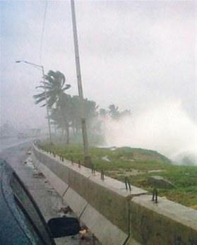
Hurricane season: June through October/November

Mon, 13 Oct 2025 18:29:13 GMT
Source: NHC Atlantic
More info and current maps
000 ABNT20 KNHC 131717 TWOAT Tropical Weather Outlook NWS National Hurricane Center Miami FL 200 PM EDT Mon Oct 13 2025 For the North Atlantic...Caribbean Sea and the Gulf of America: Active Systems: The National Hurricane Center is issuing advisories on Tropical Storm Lorenzo, located in the central tropical Atlantic. Tropical cyclone formation is not expected during the next 7 days. && Public Advisories on Tropical Storm Lorenzo are issued under WMO header WTNT31 KNHC and under AWIPS header MIATCPAT1. Forecast/Advisories on Tropical Storm Lorenzo are issued under WMO header WTNT21 KNHC and under AWIPS header MIATCMAT1. $$ Forecaster Cangialosi
...TROPICAL STORM LORENZO STRENGTHENS SLIGHTLY OVER THE CENTRAL TROPICAL ATLANTIC... As of 11:00 AM AST Mon Oct 13 the center of Lorenzo was located near 14.8, -41.2 with movement NW at 16 mph. The minimum central pressure was 1002 mb with maximum sustained winds of about 50 mph.
Issued at 1100 AM AST Mon Oct 13 2025131 WTNT32 KNHC 131451 TCPAT2 BULLETIN Tropical Storm Lorenzo Advisory Number 2 NWS National Hurricane Center Miami FL AL122025 1100 AM AST Mon Oct 13 2025 ...TROPICAL STORM LORENZO STRENGTHENS SLIGHTLY OVER THE CENTRAL TROPICAL ATLANTIC... SUMMARY OF 1100 AM AST...1500 UTC...INFORMATION ----------------------------------------------- LOCATION...14.8N 41.2W ABOUT 1150 MI...1845 KM W OF THE CABO VERDE ISLANDS MAXIMUM SUSTAINED WINDS...50 MPH...85 KM/H PRESENT MOVEMENT...NW OR 310 DEGREES AT 16 MPH...26 KM/H MINIMUM CENTRAL PRESSURE...1002 MB...29.59 INCHES WATCHES AND WARNINGS -------------------- There are no coastal watches or warnings in effect. DISCUSSION AND OUTLOOK ---------------------- At 1100 AM AST (1500 UTC), the center of Tropical Storm Lorenzo was located near latitude 14.8 North, longitude 41.2 West. Lorenzo is moving toward the northwest near 16 mph (26 km/h) and this motion with a gradual slowdown is expected through tonight, followed by a turn to the north on Tuesday. Maximum sustained winds have increased to near 50 mph (85 km/h) with higher gusts. Little change in strength is forecast through early Tuesday, but some gradual intensification is possible by the middle portion of the week. Tropical-storm-force winds extend outward up to 160 miles (260 km) from the center. The estimated minimum central pressure is 1002 mb (29.59 inches). HAZARDS AFFECTING LAND ---------------------- None. NEXT ADVISORY ------------- Next complete advisory at 500 PM AST. $$ Forecaster Hagen
Issued at 1500 UTC MON OCT 13 2025233 WTNT22 KNHC 131450 TCMAT2 TROPICAL STORM LORENZO FORECAST/ADVISORY NUMBER 2 NWS NATIONAL HURRICANE CENTER MIAMI FL AL122025 1500 UTC MON OCT 13 2025 TROPICAL STORM CENTER LOCATED NEAR 14.8N 41.2W AT 13/1500Z POSITION ACCURATE WITHIN 40 NM PRESENT MOVEMENT TOWARD THE NORTHWEST OR 310 DEGREES AT 14 KT ESTIMATED MINIMUM CENTRAL PRESSURE 1002 MB MAX SUSTAINED WINDS 45 KT WITH GUSTS TO 55 KT. 34 KT.......140NE 130SE 0SW 90NW. 4 M SEAS.... 90NE 30SE 0SW 30NW. WINDS AND SEAS VARY GREATLY IN EACH QUADRANT. RADII IN NAUTICAL MILES ARE THE LARGEST RADII EXPECTED ANYWHERE IN THAT QUADRANT. REPEAT...CENTER LOCATED NEAR 14.8N 41.2W AT 13/1500Z AT 13/1200Z CENTER WAS LOCATED NEAR 14.5N 40.8W FORECAST VALID 14/0000Z 15.6N 42.7W MAX WIND 45 KT...GUSTS 55 KT. 34 KT...120NE 100SE 0SW 70NW. FORECAST VALID 14/1200Z 17.2N 44.1W MAX WIND 45 KT...GUSTS 55 KT. 34 KT...100NE 80SE 0SW 60NW. FORECAST VALID 15/0000Z 19.2N 44.9W MAX WIND 45 KT...GUSTS 55 KT. 34 KT... 70NE 50SE 30SW 40NW. FORECAST VALID 15/1200Z 21.4N 44.9W MAX WIND 50 KT...GUSTS 60 KT. 50 KT... 20NE 20SE 0SW 0NW. 34 KT... 50NE 40SE 30SW 40NW. FORECAST VALID 16/0000Z 23.9N 43.5W MAX WIND 55 KT...GUSTS 65 KT. 50 KT... 20NE 20SE 0SW 0NW. 34 KT... 50NE 40SE 30SW 40NW. FORECAST VALID 16/1200Z 26.7N 41.2W MAX WIND 60 KT...GUSTS 75 KT. 50 KT... 20NE 20SE 20SW 0NW. 34 KT... 50NE 50SE 40SW 40NW. EXTENDED OUTLOOK. NOTE...ERRORS FOR TRACK HAVE AVERAGED NEAR 125 NM ON DAY 4 AND 175 NM ON DAY 5...AND FOR INTENSITY NEAR 15 KT EACH DAY OUTLOOK VALID 17/1200Z 31.4N 34.4W MAX WIND 55 KT...GUSTS 65 KT. 50 KT... 20NE 25SE 25SW 0NW. 34 KT... 40NE 50SE 50SW 40NW. OUTLOOK VALID 18/1200Z 31.8N 29.8W MAX WIND 45 KT...GUSTS 55 KT. 34 KT... 50NE 50SE 50SW 40NW. REQUEST FOR 3 HOURLY SHIP REPORTS WITHIN 300 MILES OF 14.8N 41.2W NEXT ADVISORY AT 13/2100Z $$ FORECASTER HAGEN
Issued at 1100 AM AST Mon Oct 13 2025000 WTNT42 KNHC 131453 TCDAT2 Tropical Storm Lorenzo Discussion Number 2 NWS National Hurricane Center Miami FL AL122025 1100 AM AST Mon Oct 13 2025 Lorenzo has maintained a large area of convection with cold cloud tops, although the latest GOES-19 1-minute visible satellite images suggest that the low-level center is near the southwestern edge of this convection, which makes sense due to the strong southwesterly wind shear over the cyclone. Overall, Lorenzo's structure hasn't changed much over the past 6 hours. However, a timely recent ASCAT pass shows a large area of 40-45 kt winds mainly in the northeast quadrant, so the initial intensity is increased to 45 kt, which is slightly above the latest objective current satellite intensity estimates from UW-CIMSS. The initial motion estimate is northwestward, or 310 degrees at 14 kt. Lorenzo is near the southwestern periphery of a mid-level high centered near the Cabo Verde Islands. Farther northwest, a mid- to upper-level trough is acting to erode the subtropical ridge. This trough is expected to fracture and shift to the southwest of the system, and Lorenzo should turn northward on Tuesday between this feature and the eroded mid-level ridge centered over the Cabo Verde Islands. Lorenzo is forecast to recurve northeastward on Wednesday as the cyclone comes under the influence of broad-scale mid-latitude westerly flow. If Lorenzo is still alive by Friday, it could approach a weakness in steering flow, with mid- to upper-level ridging possibly centered to the north or northeast of the cyclone, so the track forecast shows a slowdown with a turn to the east in 4-5 days. The track guidance is in good agreement through the 72 hour point, but spread increases significantly after that time. The new NHC track forecast is slightly west of the previous NHC prediction through hour 60, and lies close to the HFIP Corrected Consensus (HCCA) during that time period. At Day 5, the new NHC forecast is south of the previous prediction. Lorenzo continues to experience about 25 kt of southwesterly wind shear, although the shear is forecast to decrease significantly later today, and relatively light shear is anticipated from tonight through Thursday. Ordinarily, this would lead to strengthening given the sufficently warm 27-28 C ocean temperatures, but at the same time, environmental mid-level relatively humidity is also expected to decrease substantially as the storm interacts with the upper-level trough ahead of it. This trough could also still produce some residual mid-level shear undercutting the outflow layer. Most of the intensity guidance is not that enthusiastic about Lorenzo's prospects, but there are a couple of ECMWF ensemble members and a handful of Google DeepMind ensemble members that make Lorenzo a hurricane. The NHC intensity forecast is unchanged from the previous advisory other than the slightly stronger initial intensity, and is near the high end of the intensity guidance suite, showing little change in strength in the short-term, and then gradual intensification afterwards. The NHC intensity forecast is still generally higher than the HCCA, HAFS, and the intensity consensus. There is some possibility that the aforementioned dry air could cause Lorenzo to dissipate before the end of the 5-day period, as suggested by some of the global and hurricane regional models, but the NHC forecast maintains it as a tropical storm. FORECAST POSITIONS AND MAX WINDS INIT 13/1500Z 14.8N 41.2W 45 KT 50 MPH 12H 14/0000Z 15.6N 42.7W 45 KT 50 MPH 24H 14/1200Z 17.2N 44.1W 45 KT 50 MPH 36H 15/0000Z 19.2N 44.9W 45 KT 50 MPH 48H 15/1200Z 21.4N 44.9W 50 KT 60 MPH 60H 16/0000Z 23.9N 43.5W 55 KT 65 MPH 72H 16/1200Z 26.7N 41.2W 60 KT 70 MPH 96H 17/1200Z 31.4N 34.4W 55 KT 65 MPH 120H 18/1200Z 31.8N 29.8W 45 KT 50 MPH $$ Forecaster Hagen
Issued at 1500 UTC MON OCT 13 2025000 FONT12 KNHC 131452 PWSAT2 TROPICAL STORM LORENZO WIND SPEED PROBABILITIES NUMBER 2 NWS NATIONAL HURRICANE CENTER MIAMI FL AL122025 1500 UTC MON OCT 13 2025 AT 1500Z THE CENTER OF TROPICAL STORM LORENZO WAS LOCATED NEAR LATITUDE 14.8 NORTH...LONGITUDE 41.2 WEST WITH MAXIMUM SUSTAINED WINDS NEAR 45 KTS...50 MPH...85 KM/H. Z INDICATES COORDINATED UNIVERSAL TIME (GREENWICH) ATLANTIC STANDARD TIME (AST)...SUBTRACT 4 HOURS FROM Z TIME EASTERN DAYLIGHT TIME (EDT)...SUBTRACT 4 HOURS FROM Z TIME CENTRAL DAYLIGHT TIME (CDT)...SUBTRACT 5 HOURS FROM Z TIME WIND SPEED PROBABILITY TABLE FOR SPECIFIC LOCATIONS CHANCES OF SUSTAINED (1-MINUTE AVERAGE) WIND SPEEDS OF AT LEAST ...34 KT (39 MPH... 63 KM/H)... ...50 KT (58 MPH... 93 KM/H)... ...64 KT (74 MPH...119 KM/H)... FOR LOCATIONS AND TIME PERIODS DURING THE NEXT 5 DAYS PROBABILITIES FOR LOCATIONS ARE GIVEN AS OP(CP) WHERE OP IS THE PROBABILITY OF THE EVENT BEGINNING DURING AN INDIVIDUAL TIME PERIOD (ONSET PROBABILITY) (CP) IS THE PROBABILITY OF THE EVENT OCCURRING BETWEEN 12Z MON AND THE FORECAST HOUR (CUMULATIVE PROBABILITY) PROBABILITIES ARE GIVEN IN PERCENT X INDICATES PROBABILITIES LESS THAN 1 PERCENT PROBABILITIES FOR 34 KT AND 50 KT ARE SHOWN AT A GIVEN LOCATION WHEN THE 5-DAY CUMULATIVE PROBABILITY IS AT LEAST 3 PERCENT. PROBABILITIES FOR 34...50...64 KT SHOWN WHEN THE 5-DAY 64-KT CUMULATIVE PROBABILITY IS AT LEAST 1 PERCENT. - - - - WIND SPEED PROBABILITIES FOR SELECTED LOCATIONS - - - - FROM FROM FROM FROM FROM FROM FROM TIME 12Z MON 00Z TUE 12Z TUE 00Z WED 12Z WED 12Z THU 12Z FRI PERIODS TO TO TO TO TO TO TO 00Z TUE 12Z TUE 00Z WED 12Z WED 12Z THU 12Z FRI 12Z SAT FORECAST HOUR (12) (24) (36) (48) (72) (96) (120) - - - - - - - - - - - - - - - - - - - - - - - - - - - - - - - - - - LOCATION KT $$ FORECASTER HAGEN
5-Day Uncertainty Track last updated Mon, 13 Oct 2025 14:55:22 GMT
Wind Speed Probabilities last updated Mon, 13 Oct 2025 15:22:26 GMT
We are frequently asked: How are we supposed to behave as a tourist
when we get surprised on the island?
Two simple rules:
1. Stay home.
2. Follow the orders of the Civil Protection authorities.
All our Casas have a solid construction base, none is made of wood.
Officially a hurricane starts when wind speed exceeds 118 Km/hour. But even at 50 Km/h persons are advised to seek protection.